Venture off the beaten path to take in Arizona's diverse topography.
SHARE PAGE
Many of the Grand Canyon State's most interesting and beautiful roadways unwind after a short detour off the busier roads and highways. So take the exit ramp to experience four of Arizona's scenic drives and byways.
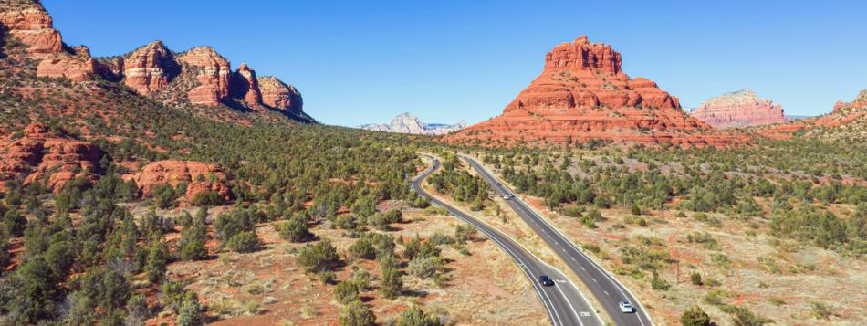
Red Rock Scenic Byway
Officially Arizona Highway 179, this byway is only 14.5 miles long. But you could spend a whole day exploring the spectacular red rock formations, shops, galleries, restaurants and other attractions that line this link between Interstate 17 and Sedona.
Get oriented at the Red Rock Ranger District Visitor Center. Then head to the Village of Oak Creek (about five miles south of Sedona) to pick up picnic supplies on the way to Bell Rock and Courthouse Butte. These two beloved and much-photographed landmarks are ringed by hiking and biking trails.
Returning to Sedona, sculptor Marguerite Brunswig Staude's Chapel of the Holy Cross is a meditative and powerful retreat, with windows framing buttes and rock outcroppings. At the northern end of the drive, stroll around Tlaquepaque, an architecturally authentic Spanish Colonial village that houses galleries, retailers and restaurants.
Road tip: A Red Rock Pass ($5/day) is required for vehicles parked on National Forest land around Sedona and Oak Creek Canyon. If you plan to park and explore on foot, pick up a pass and display it on the dash of your vehicle or RV.
Apache Trail Historic Road
On this winding 41.5-mile road, just off U.S. Highway 60 near Greater Phoenix, designate a driver to keep their eyes on curves and hairpin turns while passengers "ooh" and "ahh" over the lakes, desert mountains, and canyons in Tonto National Forest's wilderness areas.
Part paved and part well-graded gravel, the road, Arizona Highway 88 was an old stagecoach route that shuttled in supplies for Roosevelt Dam's construction in the early 1900s. It begins near Goldfield Ghost Town, a re-created Wild West town, complete with gunslingers. You'll pass Canyon Lake, where you can cruise on the Dolly Steamboat.
Road tip: Due to its narrow width and tight turns, this route is not recommended for large vehicles, such as RVs or trucks with trailers.
Swift Trail
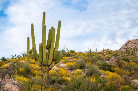
This 35-mile Arizona Highway 366 travels up one of Arizona's famous sky islands—Mount Graham in the Coronado National Forest's Pinaleño Mountains. Rising more than 7,000 feet in elevation, this upward trip is the ecological equivalent of driving from Mexico to Canada.
Pick up the trail outside Safford, north of Interstate 10, in the southern part of the state. traverse mountainous grades—through cacti and ocotillos at lower elevations, then oaks, sycamores and pines at higher elevations. Look for Heliograph Peak, where the Army sent mirrored signals during the Apache Wars, plus spots for picnics and hikes. After about 22 miles the pavement ends, and a well-graded dirt road begins, leading to your final stop—a small lake.
Road tip: The last stretch of the route is only open from mid-April to mid-November, weather permitting. Want someone else to drive? Join a van tour to Mount Graham International Observatory's three telescopes. Tours leave from Eastern Arizona College's Discovery Park Campus in Safford and run May through October.
Sonoita to Patagonia
Starting near Vail on Interstate 10, pick up this 52-mile drive south on State Route 83 through the Santa Cruz River Basin of southeastern Arizona.
In Sonoita, visit the nearby wineries of Arizona's burgeoning wine country. For lunch, drop by The Cafe, a quaint spot for creative local cuisine. Then connect back with State Route 82 heading south and watch the landscape morph from rolling grasslands to cottonwood stands and juniper forests.
In Patagonia, wander the town's charming coffee shops and retailers. Or bring your binoculars to spot wildlife at the Patagonia-Sonoita Creek Preserve, one of the most popular birding spots in the U.S., home to more than 300 species of birds. Keep the fun going with a visit to the Patagonia Lake State Park where visitors hike, swim, fish and camp, all while taking in the lush landscape of the surrounding hills.
Road tip: Embark on this road trip March and April to see the wildflowers in full bloom.
Kingman to Pearce Ferry
Fun fact #1: Joshua Trees are yucca, a hardy desert species of shrubs.
Fun fact #2: Arizona boasts its own Joshua Tree forest. That's right, you don't have to travel to California to glimpse these otherworldly plants.
Along Arizona's western border, the 69-mile Joshua Tree Parkway carves through the Hualapai Valley where hundreds upon hundreds of Joshua Trees stretch their twisty, spiky arms out to one another.
Start in Kingman, driving Stockton Hill Road to eventually connect with Pierce Ferry Road. As you head north, you'll see the craggy Cerbat Mountains to the west and the Grand Wash Cliffs to the east. Go slowly, the better to enjoy the majestic sights of the wild horses that roam this area.
When you reach Pierce Ferry Road, turn right. The unpaved road is smooth and leads you to Pearce Ferry (spelled differently than the road of the same name), the boundary between Lake Mead and the Grand Canyon. Settle in for primitive lakeside camping or a picnic with a view.
Road tip: Rain can put a damper on this trip as the main route crosses several washes that can become easily flooded during a heavy rainstorm. Before you hit the road, check the weather forecast.
About the Author
Nora Burba Trulsson
Nora Burba Trulsson is a long-time Arizona resident and a freelance writer specializing in travel, food, lifestyle, architecture and design topics. Her articles have appeared in Phoenix Home & Garden, Arizona Highways, Sunset, houzz.com, Valley Guide, Modern Luxury Scottsdale and other publications and websites.