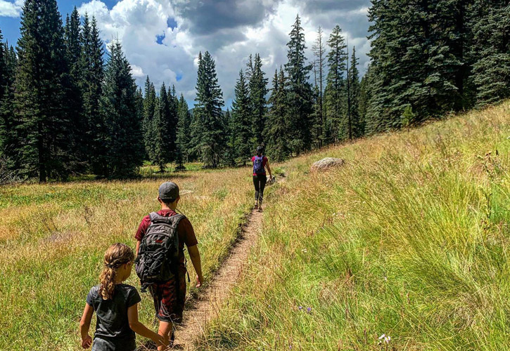
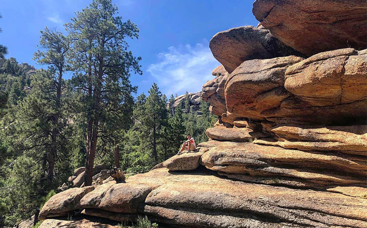
Arizona's Backcountry Experiences and (Mostly) Hidden Hikes
Arizona's backcountry is the perfect place for experienced hikers to expand their trail horizons.
The following adventures and lesser-known hiking gems range from moderate to difficult, but they share several qualities in common: getting away from the crowds and immersing yourself in the most diverse ecosystems, wildlife and scenic beauty that Arizona has to offer.
Note: Backcountry trails are, by definition, remote and isolated, often without services or access roads. Even trails categorized as "easy to moderate" require a higher than average level of hiking experience and preparation. In some cases, specialized equipment and vehicles may be necessary. Before you hit the trail, we strongly recommend you visit Appreciate AZ to brush up on Leave No Trace principles and important outdoor tips for experiencing Arizona's wildlands.
The Arizona Trail
The Arizona National Scenic Trail comprises 43 passages along 800 miles from the Arizona-Mexican border to the Arizona-Utah border. These two passages offer much in the way of backcountry exploration.
- Passage 34 San Francisco Peaks
Nearest town: Flagstaff
Distance: 35.3 miles point-to-point
Difficulty level: Moderate
This trail skirts the southern and western flanks of the San Francisco Peaks, starting at Schultz Pass a few miles north of Flagstaff and terminating further north at Cedar Ranch. Along the route, hikers are treated to outstanding views of Agassiz and Humphreys Peaks (Arizona's two highest peaks) and the photogenic meadow around Bismarck Lake—with plenty of chances to spot elk, deer and other wildlife. This long trek is well suited to backpacking and camping, with water at Schultz Tank and Alfa Fia Tank, and sometimes at Kelly and East Cedar tanks (make sure to bring a purifier).
- Passage 23 Mazatzal Divide
Nearest town: Payson
Distance: 24.3 miles point-to-point
Difficulty level: Moderate
The Mazatzals cut an imposing figure to the west as you drive along the Beeline Highway (Hwy 87), but the hike from the Mt. Peeley Trailhead to Red Hills Trail junction provides a solitary wilderness experience far from the hum of tires. Much of the trail tracks along the ridgeline, offering spectacular views both east and west. Brody Seep junction, where Chilson Camp can be found, is one of the recommended areas to set up for the night. Water, which must be purified, can generally be found at Bear Spring, Chilson Spring, Horse Camp Seep and Hopi Spring.
Kelsey-Dorsey Loop
Nearest town: Flagstaff
Distance: 7.3-mile loop
Difficulty level: Moderate
The adventure starts with the drive to the trailhead—about 21 miles of rugged road from the turnoff from Route 66 onto Forest Road 231—and it's best navigated with a four-wheel-drive vehicle. The benefit, of course, is that the jostling ride keeps traffic to a minimum, leaving you in peace to enjoy the panoramic vistas (particularly of Sycamore Canyon), lush vegetation, natural springs and wildlife. If you're not doing a day hike, the camping area near Dorsey Spring offers an outstanding option for sleeping under the stars.
Hell's Gate Trail
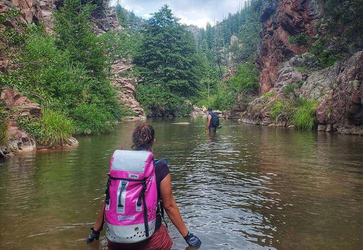
Credit: @wanderlust.nation on Instagram
Nearest town: Payson
Distance: 14.5 miles round-trip
Difficulty level: Strenuous
Twelve miles east of town, this trail descends from the pine forest into a gorgeous canyon where Tonto Creek flows into Haigler Creek. The hike in has some ups and downs, prior to a final stretch that drops 1,800 feet in 2.5 miles—and you can anticipate taking almost twice as much time and stamina to climb back out. If anything, it's an excuse to spend a night in the canyon, enjoy the swimming hole and bring your gear to fish for trout. Be forewarned that summer weekends will be busy. The creek water is potable if filtered.
Bear Mountain
Credit: @kenharris85 on Instagram
Nearest town: Sedona
Distance: 4.6 miles round-trip
Difficulty level: Strenuous
Bear Mountain, one of the tallest peaks in Sedona, earns its name from its vague resemblance to Ursus americanus, but you won't encounter any of Yogi's relatives on this hike. Among the many hikes in the area, this is among the less-heavily trafficked due to the rough terrain and steep ascents on several false summits as well as the peak itself. The exertion of climbing 1,800 feet in 2.3 miles pays off with 360-degree views of the red rocks, Jerome, Kendrick and the distant San Francisco Peaks. This is a day hike only and requires a $5 Red Rock Pass that you should purchase prior to hitting the trail.
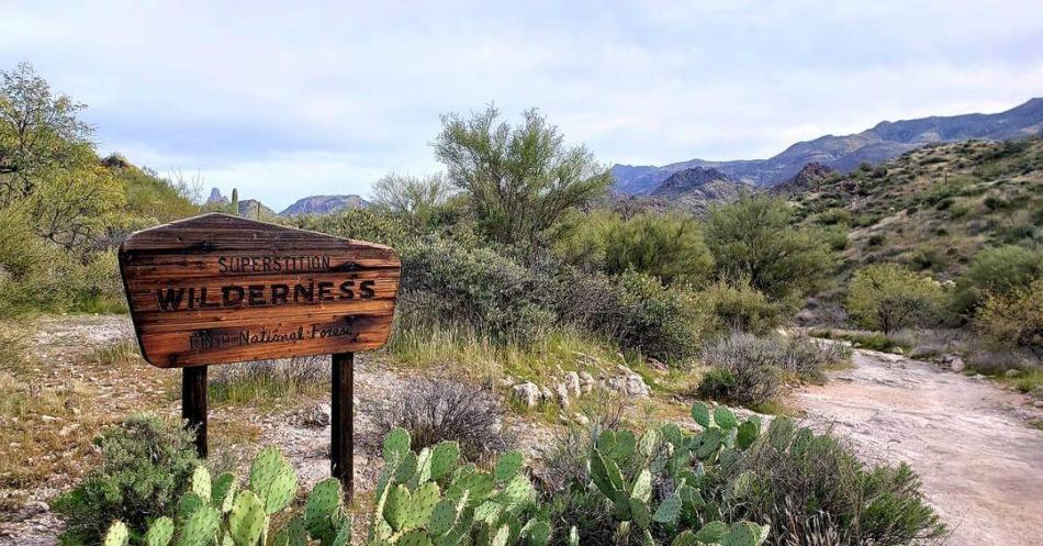
White Rock Springs
Nearest town: Mesa
Distance: 23 miles round-trip
Difficulty level: Moderate
This multiday hike starts at one of the easiest places to access the Superstition Wilderness, First Water Trailhead. Civilization soon disappears as the trail weaves through the iconic Superstition Mountains through towering saguaros, by jumping cholla cacti and in full view of the 1,000-foot Weaver's Needle. Due to loose rocks and steep sections, hiking poles are helpful. There are plenty of backcountry camping opportunities to rest up at night; before you go, get your pass and the current water report from the Tonto National Forest Mesa Ranger District.
West Baldy Trail
Credit: @krisheap on Instagram
Nearest town: about an hour east of Pinetop-Lakeside
Distance: 14 miles round-trip
Difficulty level: Moderate
A variety of evergreen species, alpine meadows, giant boulders and wildlife from black bears and deer to mountain lions and beavers make this a must-hike in the Apache-Sitgreaves National Forest. It's also on the peak-bagger bucket list at #7 in Arizona; although Baldy Peak is only open to tribal members, the highest point of the ridge (11,420 feet) is on Forest Service land. You'll encounter other hikers at lower elevations, but eventually steep switchbacks thin the crowds—and open up expansive views.
Mount Wrightson Trail
Nearest town: Tucson
Distance: 13.1-mile loop
Difficulty level: Strenuous
Because this is one of the favorite hikes within the Santa Rita Mountains, you might not be flying solo to the top of Tucson's tallest peak, 9,456-foot-high Mount Wrightson. Old Baldy Trail (not to be confused with West Baldy Trail) is the more challenging of two routes to breathtaking summit views, taking switchbacks from the wildflower-strewn Sonoran desert into the Ponderosas and Douglas firs. The 13.1-mile Super Trail (a.k.a., Loop Trail) is easier and generally has fewer hikers. Note: Spend time on the Arizona Trail, Passage 5 Santa Rita Mountains, just to the east.
Hualapai Peak Trail
Credit: @neroZ77 on Instagram
Nearest town: Kingman
Distance: 8.1-mile loop
Difficulty level: Moderate
Start on the Potato Patch Loop, which most hikers take clockwise, before spurring off to the highest point in Mohave County. Enormous granite rocks and outcroppings are a primary feature along the trail, transitioning to huge pillars at the top. The climb gets tougher in the final 2 miles towards the top, with a bit of scrambling and bushwhacking, and a sign noting where there's a 23% pitch. Summer can be toasty—with the ever-present possibility of monsoon storms in July and August—but if you're lucky, you might be greeted by friendly ladybugs. Located in Hualapai Mountain Park, $10 day-use rate per vehicle.

Sustainability
Leave No Trace
The Arizona Office of Tourism and the Leave No Trace Center for Outdoor Ethics© forged a partnership to promote sustainable tourism practices...
Must Do
Arizona's Easiest Trails and Activities for Beginners
Venturing into the great outdoors can seem a bit daunting at first. Here are some beginner-friendly suggestions to get you started and have you...
Top Tips
8 Tips All Arizona Visitors Should Know
Much has changed in the past few months, including how we travel. To ensure every one of Arizona's visitors enjoys their trip, we've gathered...