Travelers zipping up and down I-17 between Phoenix and Flagstaff often miss these interesting ruins right off the highway. A short, rugged hike or a longer, bumpy drive leads to a canyon nestled between two mesas. Hikers find a petroglyph site at the bottom of the canyon on Badger Springs Trail, while visitors with high-clearance vehicles drive to the top of a mesa to explore the remnants of ancient pueblo communities. From either route, be on the lookout for wildlife in the area including antelope, deer, javelina, bobcats and eagles that thrive in the canyon’s riparian forest.
Hike In
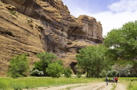
Take exit 256 off I-17 to reach Badger Springs Trail, just a few hundred feet off the interstate. The rocky trail descends into a boulder-filled canyon surrounded by steep cliffs. The trail crisscrosses the sandy wash and is easy to lose. When in doubt, hike along the dry wash until the trail comes back into view. When hikers reach the area of shade trees surrounded by fields of boulders, they veer right to reach the river via a hard-packed wash or veer left to clamber over boulders to reach the river. At the confluence of the Agua Fria River and Badger Springs Wash, search the rocks to find dozens of petroglyphs hidden in plain sight.
Drive In
Take Bloody Basin Road off I-17 to reach the mesa overlooking the canyon. Along this 10-mile stretch of dirt road, expect to see other high-clearance vehicles and OTVs heading to Pueblo La Plata — ruins of a former village with nearly 100 rooms atop the mesa. This is the largest archaeological site in the monument with an access road. From there, set off on foot to discover more evidence of prehistoric activity in the area, including terraces and berms used to capture rainwater for farming. Agua Fria National Monument has undeveloped areas for camping, either along the canyon floor or atop the remote mesas. Pack in everything you need and pack it all back out.
Explore More Archaeological Sites
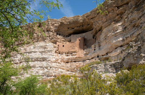
Nearby archaeological sites add to Arizona’s rugged record of human history. Just north of Camp Verde, Montezuma Castle National Monument features one of the best-preserved cliff dwellings in the state, occupied nearly 1,000 years ago by Sinagua people. Just 10 miles north of the castle, marvel at more petroglyphs at V-Bar-V Heritage Site, which boasts the largest concentration of rock art in Arizona.
For More Information
Hassayampa Field Office
21605 North 7th Ave
Phoenix, AZ 85027
(623) 580-5500
Visit Destination Website