Arizona Trail
Sycamore Canyon
The Arizona National Scenic Trail—known as the “AZT”—traverses the entire state. But you don’t have to tackle all 800 miles at once. This dayhike takes you through a beautiful canyon and on the hillsides above it with views of the rugged Mazatzal Mountains and foothills of the Four Peaks.
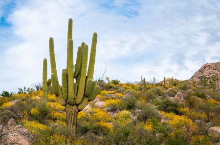
This passage of the Arizona Trail (AZT) crosses beautiful Sycamore Canyon, a riparian area with large trees. This is a great spot for wildflowers and cactus blooms in the spring months as well as fall color around November. When I hiked it at the beginning of May, there was running water and plenty of sweet shade in the creek.
On the Trail
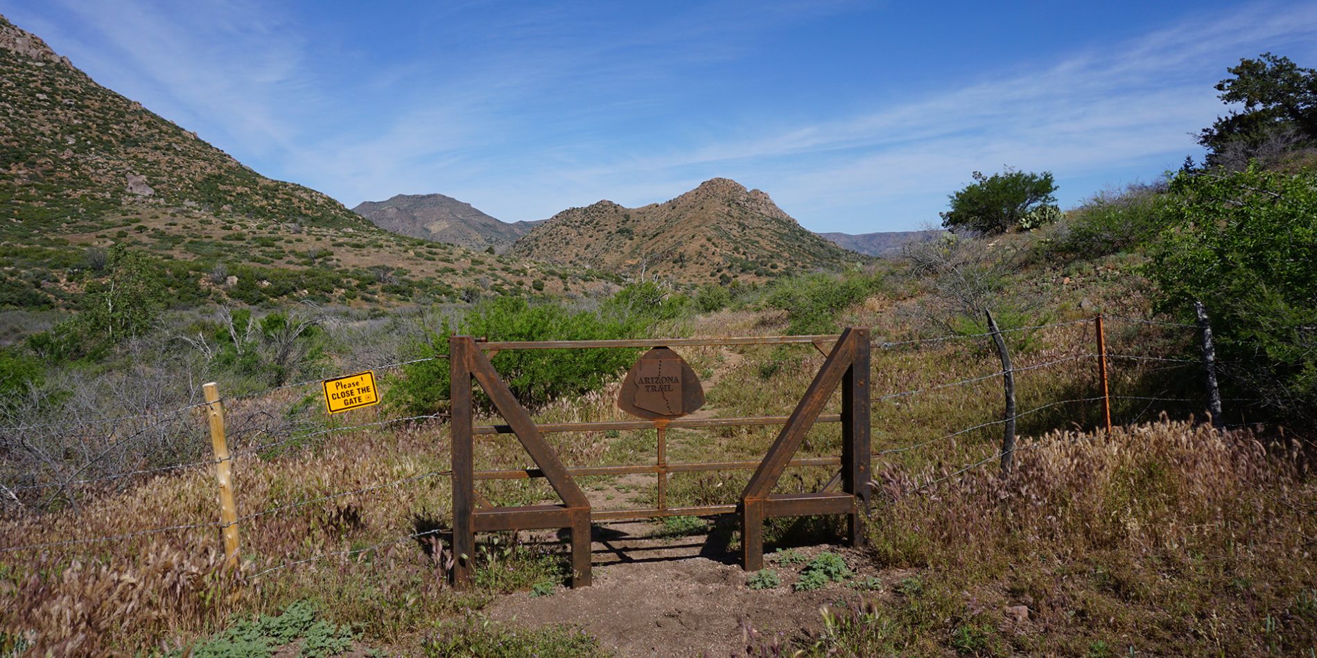
From the parking area, head south towards the gate and go through the space on the left (east) side (3,439 feet). The sign to the right (west) says “Bushnell Tanks area closed temporarily due to vegetation rehabilitation and stream crossing hazards; unauthorized entry prohibited”. This only applies to vehicles. The closure for habitat restoration was necessary after the area was damaged by overuse.
In 100 feet, come to an Arizona Trail kiosk that says Bushnell Tanks Trailhead with a second panel that illustrates best practices on sharing the trail with horses and mountain bikes. Continue down the closed road as it curves to the left (south) at 0.1 mile and then crosses a creek bed at 0.2 miles. Along with the namesake Sycamore you can see Juniper, Acacia and Cottonwood trees. Fall colors are great here, but they don’t occur until November.
*At 0.3 miles the road makes a curve to the left (east) at a brown sign with two hikers and an arrow pointing right (south). Take this trail down into the creek bed of Sycamore Canyon and keep your eyes open for signs leading you across.
In 0.1 mile, there is a sign that says “Access to Arizona Trail” with an arrow. There is another sign pointing the way that you came. Make a right (west) and join the creek bed. There should be a cairn (a stack of rocks) marking the turn, but these sometimes get washed away. In 300 feet the trail leaves the creek bed to the left (south) at a sign that says access to Arizona Trail.
Follow this to the west beneath the canopy of sycamore trees. At 0.5 miles there is another cairn and brown carsonite sign. The trail curves to the right (west) to parallel Sycamore Creek, then crosses a small tributary that may have running water. Parallel the creek until it reaches a spot where it must be crossed. You may have to look up and down the creek to find the best spot to cross on rocks and keep your feet dry. The crossing is just downstream of a concrete square. During higher flows, dry crossings may not be possible.
Look across the creek to the south and up the hill for a trail ascending out of the canyon with a brown carsonite sign pointing right. Cross the second arm of the creek wherever you can and take the trail up to the sign (3,382 feet).
At 0.6 mile, turn right (west) and follow the cairns as the trail curves to the right (south). Go up two switchbacks and climb to a cowboy gate. Please leave gates the way you find them. In 0.1 mile, there are signs at the junction for Sunflower Trail #344, Little Saddle Trail #244 and Boulder Creek Trail #73. Make a left (east) to follow the Boulder Creek Trail and pass a large metal Arizona Trail sign. The trail curves into a small drainage and climbs out of it, then switchbacks to the right (southeast) at 0.75 mile.
Switchback left (north) and the trail turns right (southeast). Mount Ord is visible with the towers on top to the northeast, as well as the parking area to the east across Sycamore Canyon. The trail climbs above the canyon and then levels out at mile 0.9. At mile 1.0, Sycamore Canyon comes into view with Boulder Mountain to the right. In 0.2 mile you can see the trail continuing south traversing the slope.
Cross two side canyons and ascend to the south on rocky tread beneath a rocky-topped peak. The bushes with the red bark are Manzanita and there are also Sugar sumac bushes, Beargrass, and Sotol. In the spring, you might see blooming Dudleya - small succulents with flowers on red, orange and yellow stalks.
At mile 1.6, the trail makes a short climb and then takes a sweeping curve to the right (east). Saddle Mountain, also on the AZT, can be seen across the highway and valley to the northwest. In 0.2 mile, the trail makes the turn to the left (northeast) then right (south) and then does a series of switchbacks descending to the southeast.
At mile 2.0, a rocky peak comes into view on the right as the trail descends into the valley. The AZT turns right (south). In 0.1 mile, the trail curves to the left (east) and continues descending, then in 0.1 mile, the trail climbs and curves to left (northeast). Descend to the northeast down some rock steps to a creek crossing at mile 2.3.
This is the end of the hike with a round-trip distance of 4.6 miles. There is a small sandy beach and rocks to sit on to your right (south) (3,315 feet).
Return back the way you came.
For more information on the 800-mile Arizona National Scenic Trail, visit aztrail.org
IF you go
Trailhead: Bushnell Tanks Trailhead
GPS coordinates: 33.86250° N, 111.47278° W
Arizona Trail Passage: #21 Pine Mountain
Trailhead Elevation: 3,439 feet
Round-trip Length: 4.6 miles
Elevation gain/loss: 680 feet
Difficulty: Easy
Why go: Sycamore trees and running water, views of the Mazatzal Mountains.
Nearest Gateway Communities: Payson (33 miles north) – Sunflower has no services.
Post-hike meal: Ayothaya Thai Café is an unexpected gem in Rim Country with great lunch specials at 404 E. Highway 260. If you’re looking for more traditional fare, the Beeline Café has you covered at 815 South Beeline Highway.
Author
Sirena Rana Dufault is the author of the forthcoming book, “Day Hikes on the Arizona National Scenic Trail,” which will be published by Wilderness Press. For more information, visit trailsinspire.com