Arizona Trail
Highline: Pine Trail to Red Rock Springs
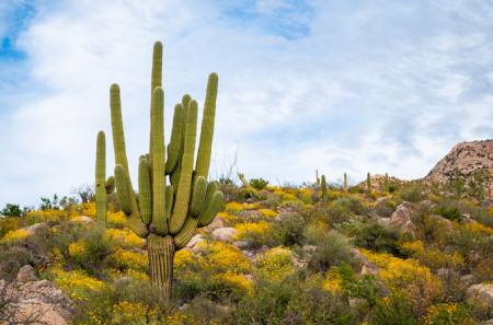
The Arizona National Scenic Trail—known as the "AZT"—traverses the entire state. But you don’t have to tackle all 800 miles at once. This day hike takes you through the gorgeous Ponderosa Pine Forest beneath the Mogollon Rim with views of the surrounding mountains and the little Gateway Communities of Pine/Strawberry.
This passage of the Arizona Trail (AZT) goes through forests with views of the Mogollon Rim (pronounced MUGGY-own), an escarpment up to 1,000 feet high that forms the edge of the Colorado Plateau. The Highline Trail was established in the 1870s as a path for transportation between homesteads beneath the Rim.
On the Trail
The trail starts on the east end of the parking lot at a hiker sign and trail register, between signs for the Pine Trailhead/ Highline Trail and a big metal Arizona Trail sign (5,394 feet). The Highline Trail was established in the 1870’s as a path for transportation between homesteads beneath the Rim. Many parts of the current 55-mile Highline National Recreational Trail have been rerouted from the original roadbed alignment to provide a better user experience on foot, bike and horseback.
In 100 feet, there is a bike access ramp to your left and then Arizona Trail gate to your right. Go through the gate and reach a Forest Service sign. The trail makes a curve to the left (northeast). In 200 feet, reach an AZT metal mileage sign that says Utah 337, Mexico 465. The trail switchbacks up the hill and reaches a junction at 0.25 mile with the Pine Canyon Trail #26 on your left (north). The AZT continues straight (east).
The trail curves through a drainage, and then heads south. There are Alligator juniper, Ponderosa pine, red-barked Manzanita, Holly scrub oak and Live oak lining the trail. This region is part of the largest Ponderosa Pine forest in the world, stretching all the way north to Flagstaff and east along the Mogollon Rim. This is a major transitional area on the Arizona Trail. North of the Mogollon Rim the AZT consists of many miles of flat hiking through Ponderosa Pine forests versus the mountainous and rugged southern part of the state.
In 0.3 mile, the trail curves to the northeast and climbs and in 0.1 mile it levels and descends to a junction with a trail coming in from the right (south). Curve left (northeast) to stay on the AZT at mile 0.75. The trail crosses a drainage and continues northeast.
The Highline Trail is marked by white diamonds on the trees. The AZT goes through the canopy, passing some Bigtooth maples on your left (southwest) in the next drainage. The trail climbs out of the drainage and turns to the right (east) and then left (north). At 1.0 mile, continue northeast to the junction with the Lower Pineview Trail to your left (west).
If you’re looking for a shorter loop, take the Lower Pineview Trail 0.8 mile left (west) to the Pine Canyon Trail and make a left (south) 0.7 mile to the Highline Trail and make a right (west) to return to the trailhead for a 2.7-mile round-trip hike.
Two trails go right, take the hard right to stay on the Highline to Red Rock Spring. Descend and cross the drainage, you will see a wooden AZT sign and a white diamond to the east. The trail switchbacks to the left (northeast) and then right (south) and at mile 1.25 the trail curves into more open terrain with views of Milk Ranch Point to the northeast. The trail continues switchbacking up the hill, the tread in this passage is dirt with rocky sections.
In 0.4 mile, you can catch glimpses of the Pine/Strawberry valley to your right (west) with Deadman Mesa to the southwest. In 0.3 mile, get sweeping views of the valley all the way to the south of the Mazatzal mountains.
The AZT gradually curves to head northeast and continues climbing. At mile 2.3 the trail curves right (southeast) at a flat wooded area. In 0.4 mile, reach the junction for the Donahue Trail #27. The Highline Trail continues straight (southeast) at a sign that says Geronimo Trailhead left, Pine Trailhead right.
The AZT climbs and traverses a drainage into an area with red soil at mile 3.0. In 0.1 mile, the trail makes a hard turn to the left (northeast) and goes through a flat area with a campsite and logs to sit on to the right (southeast).
After the saddle, the view opens up and you can see the Mogollon Rim stretching out to the east, and the mesas north of Payson, the town of Payson and the Sierra Ancha in the distance to the south. Go up the hill northeast on red rock steps, continuing a steep climb for 0.2 mile, reaching the high point at 6,290 feet. The vegetation opens up and you can see Four Peaks, Mount Ord and the Mazatzal Mountains.
The trail descends and contours across the hillside. In 0.3 mile, the AZT curves right (southeast), descends and crosses a drainage, and in 0.1 mile turns right (south) and climbs out then switchbacks left (northeast). At mile 3.75, switchback right (southeast) and the climb becomes less steep, flattens out in 0.1 mile, then starts a descent on red rock steps for 0.3 mile to a drainage crossing. The trail climbs back out of the drainage to the east for 0.1 mile then descends to cross another drainage, which may have water in it.
Pass through a camping area with good spots to sit and take a break. 50 feet past the camping area is Red Rock Spring at 4.5 miles, elevation 6,000 feet. Red Rock Spring is piped into a concrete tank. It might not look like much depending on where you're from, but water sources and seasonal springs like this are very important for Arizona Trail hikers.
Return the way you came.
For more information on the 800-mile Arizona National Scenic Trail, visit aztrail.org
If you go
Trailhead: Pine Trailhead
GPS coordinates: 34.37412 N, -111.44341 W
Arizona Trail Passage: #26 Highline
Trailhead Elevation: 5,394 feet
Round-trip length: 9 miles
Elevation gain/loss: 1700 feet
Difficulty: Moderate
Short hike: 2.7-mile loop/300 feet/Easy
Why go: Views of the Mogollon Rim and surrounding mountains
Nearest Gateway Communities: Pine/Strawberry
Post-hike meal: THAT Brewery (3270 N. Highway 87), Elk and beef chili topped with THAT beer cheese with an Arizona Trail Ale; a portion of the beer’s proceeds go toward supporting the Arizona Trail Association.
Author
Sirena Rana Dufault is the author of the forthcoming book, “Day Hikes on the Arizona National Scenic Trail,” which will be published by Wilderness Press. For more information, visit trailsinspire.com